Milestones:First Digitally Processed Image from a Spaceborne Synthetic Aperture Radar, 1978
Title
First Digitally Processed Image from a Spaceborne Synthetic Aperture Radar, 1978
Citation
In November 1978, a team from MacDonald, Dettwiler and Associates Ltd. (MDA) became the first to use a digital processor to reconstruct an image from Seasat-A, the first civilian spaceborne synthetic aperture radar (SAR). MDA engineers subsequently developed three of the four most important SAR digital processing algorithms that replaced the optical processing methods used previously.
Street address(es) and GPS coordinates of the Milestone Plaque Sites
, 13800 Commerce Parkway Richmond, British Columbia V6V 2J3, Canada latitude, longitude: 49.1753696, -123.0704193
Details of the physical location of the plaque
We propose to mount the plaque in the lobby of MDA's headquarters.
How the plaque site is protected/secured
The plaque will be located in the lobby, which is outside the secure area of the building. All visitors to MDA will be able to view the plaque alongside other historical exhibits including a scale model of the Prince Albert Earth Station, the Canadarm, etc.
Historical significance of the work
From the time that Carl A. Wiley of Goodyear Aircraft Co. introduced the synthetic aperture radar (SAR) concept in 1951, optical correlators based upon various combinations of exotic lenses and optical film had been used to reconstruct synthetic aperture radar imagery. While reconstruction could be accomplished in reasonable time using such techniques, the results suffered from various artifacts associated with slight physical imperfections in the optical system and the limited dynamic range of the optical system. While the possibility of using digital technology to process SAR data had been recognized early on, the processing requirements greatly exceeded the capabilities of the general purpose computers available to researchers in the 1950's and 1960's. The state of the art as of 1970 is summarized in [1]. At the same time, it had been recognized that a synthetic aperture radar carried by an orbiting satellite would offer many important advantages over airborne SARs. First, orbiting Earth observation satellites can achieve worldwide coverage with an ease that airborne platforms cannot match. Second, orbiting SARs are not buffeted by the atmospheric turbulence that shakes airborne SARs; the path that they take through airless space is ultra smooth and highly predictable. These advantages are only partially offset by the reduced resolution and lower signal-to-noise ratio achievable with orbital SAR imagery due to their much greater height above the Earth's surface. Tremendous advances in minicomputer technology during the early 1970's renewed interest in the possibility of placing a synthetic aperture radar in low earth orbit and using general purpose computers to produce high quality imagery from the downlinked data. Seasat-A. the world's first orbital SAR, was launched by NASA in 1978. Although it failed within 90 days of achieving orbit due to a power system defect, Seasat-A demonstrated the enormous potential of orbital SARs and ushered in three decades of innovation that saw orbital SARs of ever increasing power and capability launched by NASA, the European Space Agency and the Canadian Space Agency. Several teams competed to be the first to reconstruct a scene by digitally processing Seasat-A SAR data. However, the general purpose minicomputers available to engineers in the late 1970's were only barely capable of supplying the enormous processing power required. It was widely expected that a large, well-funded team from NASA's Jet Propulsion Laboratory would prevail. Instead, a small, upstart team from Canada's MacDonald Dettwiler and Associates that had begun their task two years earlier won the race in November 1978 [2]. So significant was the accomplishment that this first image was featured in the 26 February 1979 issue of Aviation Week and Space Technology [3]. Details were reported at several conferences early in 1979 [4],[5]. JPL was behind and as recently as 1980 was still reporting results that had been processed using the less capable optical techniques [6].
Features that set this work apart from similar achievements
The events of November 1978 marked a turning point in the history of synthetic aperture radar. Demonstration that data from spaceborne SARs could be digitally processed using general purpose digital computers helped to dramatically reduce the cost of SAR imagery and make it much more widely available for civilian applications. Until 1978, military applications of SAR were predominant. Since 1978, civilian applications of SAR have assumed steadily increasing importance. The reputation that MDA earned from this accomplishment fuelled its rapid growth into the world's largest supplier of SAR processors and Canada's largest space technology company.
Significant references
[1] R. O. Harger, "Synthetic Aperture Radar Systems: Theory and Design." Academic Press, New York, 1970.
[2] Herbert J. Kramer, "Observation of the Earth and Its Environment: Survey of Missions and Sensors," 4th ed., Springer, 2002, p. 32.
[3] "Seasat Imagery Shows St. Lawrence," Aviation Week and Space Technology, 26 Feb. 1979. [Clipping Available Online.] http://rsl.ece.ubc.ca/AWST-Seasat-26Feb1979.png
[4] I. Cumming and J. Bennett, "Digital processing of Seasat SAR data," in Proc. IEEE ICASSP '79, Apr 1979, pp. 710-718. [Available Online.] http://ieeexplore.ieee.org/stamp/stamp.jsp?tp=&arnumber=1170630
[5] John R. Bennett and Ian G. Cumming, "A Digital Processor for the Production of Seasat Synthetic Aperture Radar Imagery," LARS Symposia, Purdue Univ., 1979, Paper 316. [Available Online.] http://docs.lib.purdue.edu/lars_symp/316
[6] R. L. Jordan, "The Seasat-A synthetic aperture radar system," IEEE Journal of Oceanic Engineering, vol. 5, no. 2, pp. 154-164, Apr. 1980. [Available Online.] http://ieeexplore.ieee.org/stamp/stamp.jsp?tp=&arnumber=1145451
[7] I. G. Cumming and F. H. Wong, “Digital Processing of Synthetic Aperture Radar Data”, Artech House, 2005. [Summary Available Online.] http://www.artechhouse.com/Main/Books/Digital-Processing-of-Synthetic-Aperture-Radar-Dat-643.aspx
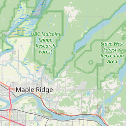
Map


