SELF-GUIDED TECHNICAL HISTORY TOUR OF OTTAWA CANADA AND NEARBY
UNDER CONSTRUCTION. PLEASE CHECK BACK
This tour was constructed by the Staff of the IEEE History Center. For a global map of IEEE Milestones, ASCE Landmarks, and ASME Landmarks, go to the Innovation Map on the Engineering & Technology History Wiki. For a list of other Technical History Tours, please click here.
Rideau Canal
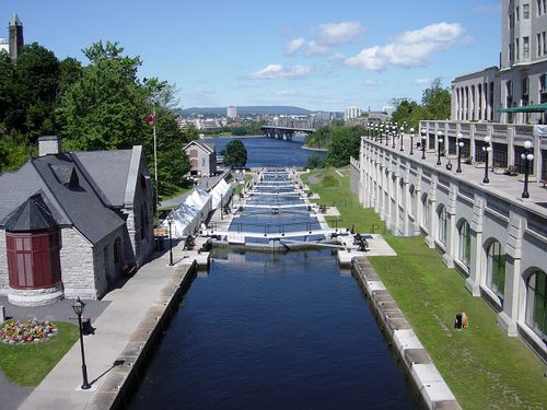
A UNESCO World Heritage Site, the Rideau Canal was built in 1832 in case of threat from the United States on the St. Lawrence River route. It provided a safe path from Montreal to the Great Lakes. The Canal has a system of large locks that where made to accommodate the new steamboats that begin to show in the Great lakes during that time. During the winter, it becomes the world’s largest ice skating rink
• https://www.pc.gc.ca/en/lhn-nhs/on/rideau/histoire-history
• http://ncc-ccn.gc.ca/rideau-canal-skateway
Loading map...
{"minzoom":false,"maxzoom":false,"mappingservice":"leaflet","width":"auto","height":"350px","centre":{"text":"","title":"","link":"","lat":45.404467,"lon":-75.680992,"icon":""},"title":"","label":"","icon":"","lines":[],"polygons":[],"circles":[],"rectangles":[],"copycoords":false,"static":false,"zoom":12,"defzoom":14,"layers":["OpenStreetMap"],"image layers":[],"overlays":[],"resizable":false,"fullscreen":false,"scrollwheelzoom":true,"cluster":false,"clustermaxzoom":20,"clusterzoomonclick":true,"clustermaxradius":80,"clusterspiderfy":true,"geojson":"","clicktarget":"","imageLayers":[],"locations":[{"text":"","title":"","link":"","lat":45.404467,"lon":-75.680992,"icon":""}],"imageoverlays":null}
Chateau Laurier Ballroom
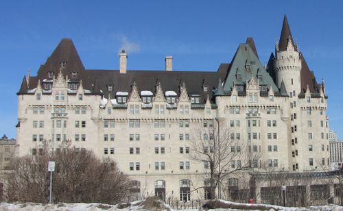
First public wireless conversation in Canada was conducted between an experimental radio station in Montreal and the Naval Radio Station in Ottawa. Château Laurier served as a secondary receiving station for Naval Radio Station. Both cities exchanged live performance from vocalists and some from phonographs. In 1924, Canadian Nation Railway would move its studious over to the Château Laurier Hotel.
• https://www.ottawamatters.com/remember-this/remember-this-hello-ottawa-hello-montreal-1464135
• http://www.broadcasting-history.ca/listing_and_histories/radio/cbo-fm
Loading map...
{"minzoom":false,"maxzoom":false,"mappingservice":"leaflet","width":"auto","height":"350px","centre":{"text":"","title":"","link":"","lat":45.4256,"lon":-75.6953,"icon":""},"title":"","label":"","icon":"","lines":[],"polygons":[],"circles":[],"rectangles":[],"copycoords":false,"static":false,"zoom":12,"defzoom":14,"layers":["OpenStreetMap"],"image layers":[],"overlays":[],"resizable":false,"fullscreen":false,"scrollwheelzoom":true,"cluster":false,"clustermaxzoom":20,"clusterzoomonclick":true,"clustermaxradius":80,"clusterspiderfy":true,"geojson":"","clicktarget":"","imageLayers":[],"locations":[{"text":"","title":"","link":"","lat":45.4256,"lon":-75.6953,"icon":""}],"imageoverlays":null}
Rideau Hall
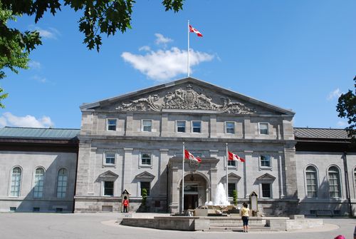
Official home to the Governor General of Canada, the first telephone line in Canada was installed on 9 November 1877, linking the office of the Premier of the Dominion of Canada to the office of the Governor General. Later, a demonstration of the phonograph was held at Rideau Hall in Ottawa, Canada on May 17, 1878
• https://www.bac-lac.gc.ca/eng/discover/films-videos-sound-recordings/virtual-gramophone/Pages/history-recorded-sound.aspx?wbdisable=true
• https://todayinottawashistory.wordpress.com/tag/invention/
Loading map...
{"minzoom":false,"maxzoom":false,"mappingservice":"leaflet","width":"auto","height":"350px","centre":{"text":"","title":"","link":"","lat":45.4445,"lon":-75.6858,"icon":""},"title":"","label":"","icon":"","lines":[],"polygons":[],"circles":[],"rectangles":[],"copycoords":false,"static":false,"zoom":12,"defzoom":14,"layers":["OpenStreetMap"],"image layers":[],"overlays":[],"resizable":false,"fullscreen":false,"scrollwheelzoom":true,"cluster":false,"clustermaxzoom":20,"clusterzoomonclick":true,"clustermaxradius":80,"clusterspiderfy":true,"geojson":"","clicktarget":"","imageLayers":[],"locations":[{"text":"","title":"","link":"","lat":45.4445,"lon":-75.6858,"icon":""}],"imageoverlays":null}
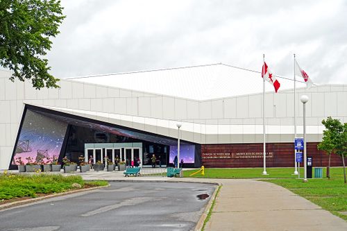
Canada Science and Technology Museum
Canada's Science and Technology Museum, 1867 St. Laurent Blvd, Ottawa, holds a fascinating collection of artifacts from many aspects of technology including agriculture, aviation, maritime, industry, photography, and railway. Highlights of the collection include a 6400 steam locomotive and an Avro Lancaster X WWII bomber. For more information see https://ingeniumcanada.org/cstm
Loading map...
{"minzoom":false,"maxzoom":false,"mappingservice":"leaflet","width":"auto","height":"250px","centre":{"text":"","title":"","link":"","lat":45.4035334,"lon":-75.621076,"icon":""},"title":"","label":"","icon":"","lines":[],"polygons":[],"circles":[],"rectangles":[],"copycoords":false,"static":false,"zoom":11,"defzoom":14,"layers":["OpenStreetMap"],"image layers":[],"overlays":[],"resizable":false,"fullscreen":false,"scrollwheelzoom":true,"cluster":false,"clustermaxzoom":20,"clusterzoomonclick":true,"clustermaxradius":80,"clusterspiderfy":true,"geojson":"","clicktarget":"","imageLayers":[],"locations":[{"text":"","title":"","link":"","lat":45.4035334,"lon":-75.621076,"icon":"","inlineLabel":"1867 St. Laurent Blvd, Ottawa, 45.4035334,-75.621076, 45.4035334,-75.621076\n"}],"imageoverlays":null}
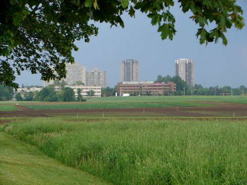
Central Experimental Farm
A National Historic site, the Central Experimental Farm was established in the 19th century as the central research station for the federal Department of Agriculture. Even today, the CEF is still a working scientific institution conducting cutting edge agricultural research. Its also home to Dominion Observatory and the Canada Agriculture and Food Museum
• https://www.atlasobscura.com/places/central-experimental-farm
Loading map...
{"minzoom":false,"maxzoom":false,"mappingservice":"leaflet","width":"auto","height":"350px","centre":{"text":"","title":"","link":"","lat":45.3875,"lon":-75.7092,"icon":""},"title":"","label":"","icon":"","lines":[],"polygons":[],"circles":[],"rectangles":[],"copycoords":false,"static":false,"zoom":12,"defzoom":14,"layers":["OpenStreetMap"],"image layers":[],"overlays":[],"resizable":false,"fullscreen":false,"scrollwheelzoom":true,"cluster":false,"clustermaxzoom":20,"clusterzoomonclick":true,"clustermaxradius":80,"clusterspiderfy":true,"geojson":"","clicktarget":"","imageLayers":[],"locations":[{"text":"","title":"","link":"","lat":45.3875,"lon":-75.7092,"icon":""}],"imageoverlays":null}
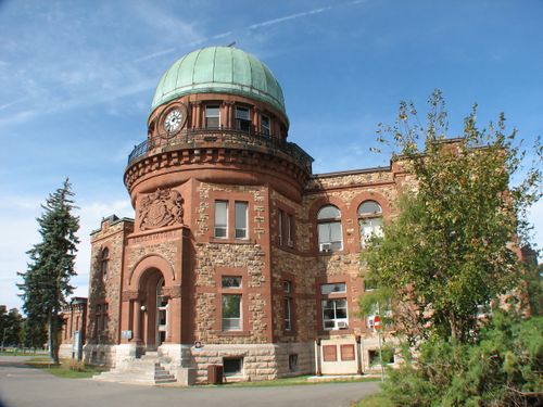
Dominion Observatory
960 Carling Ave Ottawa, Ontario, K1Y Canada
The Dominion Observatory is a classified Federal Heritage Building that was established to aid survey work of western Canada through positional astronomy. The Observatory also served as a world-class center for astronomical and geophysical research. The Dominion Observatory is one of four major public buildings constructed in Ottawa during the expansionist years of the Wilfrid Laurier government that heralded Ottawa’s transformation from a lumber town to a capital city.
• https://www.pc.gc.ca/apps/dfhd/page_fhbro_eng.aspx?id=5695
Loading map...
{"minzoom":false,"maxzoom":false,"mappingservice":"leaflet","width":"auto","height":"350px","centre":{"text":"","title":"","link":"","lat":45.3936,"lon":-75.7144,"icon":""},"title":"","label":"","icon":"","lines":[],"polygons":[],"circles":[],"rectangles":[],"copycoords":false,"static":false,"zoom":12,"defzoom":14,"layers":["OpenStreetMap"],"image layers":[],"overlays":[],"resizable":false,"fullscreen":false,"scrollwheelzoom":true,"cluster":false,"clustermaxzoom":20,"clusterzoomonclick":true,"clustermaxradius":80,"clusterspiderfy":true,"geojson":"","clicktarget":"","imageLayers":[],"locations":[{"text":"","title":"","link":"","lat":45.3936,"lon":-75.7144,"icon":""}],"imageoverlays":null}
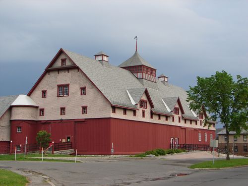
Canada Agriculture and Food Museum
901 Prince of Wales Drive, Ottawa, ON
Canada Agriculture and Food Museum is the world’s only working farm in the heart of a capital city. Museum programs and exhibitions are related to Canada’s agricultural heritage, food literacy, and the benefits and relationship of agricultural science and technology to Canadians’ everyday lives. For more information visit https://ingeniumcanada.org/cafm
Loading map...
{"minzoom":false,"maxzoom":false,"mappingservice":"leaflet","width":"auto","height":"350px","centre":{"text":"","title":"","link":"","lat":45.3875,"lon":-75.7093,"icon":""},"title":"","label":"","icon":"","lines":[],"polygons":[],"circles":[],"rectangles":[],"copycoords":false,"static":false,"zoom":12,"defzoom":14,"layers":["OpenStreetMap"],"image layers":[],"overlays":[],"resizable":false,"fullscreen":false,"scrollwheelzoom":true,"cluster":false,"clustermaxzoom":20,"clusterzoomonclick":true,"clustermaxradius":80,"clusterspiderfy":true,"geojson":"","clicktarget":"","imageLayers":[],"locations":[{"text":"","title":"","link":"","lat":45.3875,"lon":-75.7093,"icon":""}],"imageoverlays":null}
Rockcliffe Airport
Canada Aviation and Space Museum
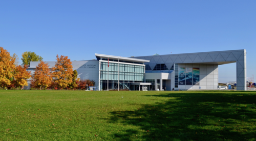
Canada Aviation and Space Museum, 11 Aviation Parkway, Ottawa, ON, has various exhibits where one can learn about the engines that power aircraft, meet an astronaut, learn about Canada’s most notable space achievements. For more information visit https://ingeniumcanada.org/casm
Loading map...
{"minzoom":false,"maxzoom":false,"mappingservice":"leaflet","width":"auto","height":"250px","centre":{"text":"","title":"","link":"","lat":45.4585,"lon":-75.6438,"icon":""},"title":"","label":"","icon":"","lines":[],"polygons":[],"circles":[],"rectangles":[],"copycoords":false,"static":false,"zoom":10,"defzoom":14,"layers":["OpenStreetMap"],"image layers":[],"overlays":[],"resizable":false,"fullscreen":false,"scrollwheelzoom":true,"cluster":false,"clustermaxzoom":20,"clusterzoomonclick":true,"clustermaxradius":80,"clusterspiderfy":true,"geojson":"","clicktarget":"","imageLayers":[],"locations":[{"text":"","title":"","link":"","lat":45.4585,"lon":-75.6438,"icon":""}],"imageoverlays":null}
First Search and Rescue Using Satellite Location Technology, 1982 (an IEEE Milestone)
The Milestone plaque may be viewed (after September 2019) at the Canadian Aviation and Space Museum, 11 Aviation Parkway, Ottawa, 45.458542,-75.6462657
Loading map...
{"minzoom":false,"maxzoom":false,"mappingservice":"leaflet","width":"auto","height":"250px","centre":{"text":"","title":"","link":"","lat":45.458542,"lon":-75.6462657,"icon":""},"title":"","label":"","icon":"","lines":[],"polygons":[],"circles":[],"rectangles":[],"copycoords":false,"static":false,"zoom":11,"defzoom":14,"layers":["OpenStreetMap"],"image layers":[],"overlays":[],"resizable":false,"fullscreen":false,"scrollwheelzoom":true,"cluster":false,"clustermaxzoom":20,"clusterzoomonclick":true,"clustermaxradius":80,"clusterspiderfy":true,"geojson":"","clicktarget":"","imageLayers":[],"locations":[{"text":"","title":"","link":"","lat":45.458542,"lon":-75.6462657,"icon":"","inlineLabel":"11 Aviation Parkway, Ottawa, 45.458542,-75.6462657\n"}],"imageoverlays":null}
On 9 September 1982 an aircraft crashed in the mountains of British Columbia. A Canadian ground station in Ottawa located the aircraft using the COSPAS-SARSAT satellite system. Search and rescue teams were dispatched and all on board were rescued. Since the first incident, many tens of thousands of lives have been saved around the world using this technology.
Research Center
Alouette-ISIS Satellite Program, (an IEEE Milestone)
The IEEE Milestone plaque may be viewed at Shirley's Bay Research Center, Ottawa, Canada, off Carling Ave/Rt 38. 45.34493, -75.882893
Loading map...
{"minzoom":false,"maxzoom":false,"mappingservice":"leaflet","width":"auto","height":"250px","centre":{"text":"","title":"","link":"","lat":45.34493,"lon":-75.882893,"icon":""},"title":"","label":"","icon":"","lines":[],"polygons":[],"circles":[],"rectangles":[],"copycoords":false,"static":false,"zoom":10,"defzoom":14,"layers":["OpenStreetMap"],"image layers":[],"overlays":[],"resizable":false,"fullscreen":false,"scrollwheelzoom":true,"cluster":false,"clustermaxzoom":20,"clusterzoomonclick":true,"clustermaxradius":80,"clusterspiderfy":true,"geojson":"","clicktarget":"","imageLayers":[],"locations":[{"text":"","title":"","link":"","lat":45.34493,"lon":-75.882893,"icon":"","inlineLabel":"Shirley's Bay Research Ctr., off Carling Ave/Rt 38, 45.34493, -75.882893\n"}],"imageoverlays":null}
Driven by the need to understand the characteristics of radio communication in Canada's North, Canadian researchers focused on the exploration of the earth's upper atmosphere, the ionosphere. Canada's satellite program commenced with the launch of Alouette-I on September 29, 1962. Alouette-II followed in 1965, ISIS-I in 1969, ISIS-II in 1971. The Alouette/ISIS tracking antenna serves as a reminder of Canada's contribution to this international effort in space science.
Communications Research Centre
“The CRC is a secure site that requires visitors to be escorted while on the premises. On arrival, you will be greeted by security staff who will issue you a visitor pass and then phone the person or party you will be visiting. A representative will then meet you, either at the guard house, or at the entrance of the appropriate building”
3701 Carling Avenue, Ottawa (Nepean), Ontario K2K 2Y7, Canada
Loading map...
{"minzoom":false,"maxzoom":false,"mappingservice":"leaflet","width":"auto","height":"350px","centre":{"text":"","title":"","link":"","lat":45.345196,"lon":-75.880435,"icon":""},"title":"","label":"","icon":"","lines":[],"polygons":[],"circles":[],"rectangles":[],"copycoords":false,"static":false,"zoom":11,"defzoom":14,"layers":["OpenStreetMap"],"image layers":[],"overlays":[],"resizable":false,"fullscreen":false,"scrollwheelzoom":true,"cluster":false,"clustermaxzoom":20,"clusterzoomonclick":true,"clustermaxradius":80,"clusterspiderfy":true,"geojson":"","clicktarget":"","imageLayers":[],"locations":[{"text":"","title":"","link":"","lat":45.345196,"lon":-75.880435,"icon":""}],"imageoverlays":null}
CRC is the Canadian government’s research laboratory for the development of telecommunication technology. A few examples of innovations and inventions are listed below.
• The photosensitivity in glass was discovered here, which lead to the development of fiber Bragg gratings
• Stationary High-Altitude Relay Platform (SHARP) was an unmanned drone who electric motor was powered by microwaves from the ground antennas (1987)
• CRC designed the HERMES satellite which operated on higher frequencies than the other satellites of its day. It showed the feasibility of direct-to-home broadcasting with a demonstration streaming a Stanley Cup playoff game
This link includes a list of several different milestones by the CRC: https://www.ic.gc.ca/eic/site/069.nsf/vwapj/CRCHighlights-2008-09-eng.pdf/$file/CRCHighlights-2008-09-eng.pdf
Quebec/Ottawa
Alexandria Bridge (Interprovincial Bridge)
Although built between 1898 and 1900, this Steel truss cantilever bridge has gone through several renovations. In the 50s, the bridge was upgrades to handle vehicles and pedestrians. The Bridge is Considered a National Historic Civil Engineering Site by The Canadian Society for Civil Engineering
• http://www.ahcustom.com/featured_projects/royal-alexandra-bridge.html
• https://www.tpsgc-pwgsc.gc.ca/biens-property/pdb-bdd/alexandra-eng.html
Loading map...
{"minzoom":false,"maxzoom":false,"mappingservice":"leaflet","width":"auto","height":"350px","centre":{"text":"","title":"","link":"","lat":45.42992,"lon":-75.70371,"icon":""},"title":"","label":"","icon":"","lines":[],"polygons":[],"circles":[],"rectangles":[],"copycoords":false,"static":false,"zoom":12,"defzoom":14,"layers":["OpenStreetMap"],"image layers":[],"overlays":[],"resizable":false,"fullscreen":false,"scrollwheelzoom":true,"cluster":false,"clustermaxzoom":20,"clusterzoomonclick":true,"clustermaxradius":80,"clusterspiderfy":true,"geojson":"","clicktarget":"","imageLayers":[],"locations":[{"text":"","title":"","link":"","lat":45.42992,"lon":-75.70371,"icon":""}],"imageoverlays":null}
Electric Streetcar Line, 1891 (Canadian Museum of History)
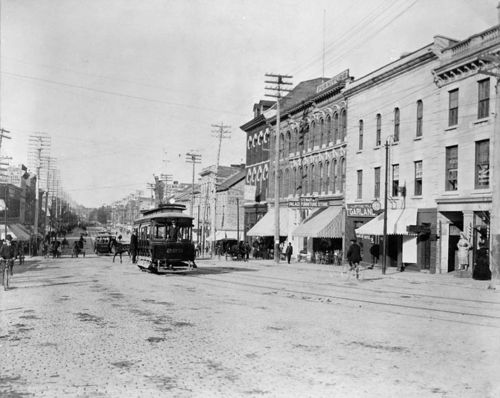
Ottawa introduced electric street cars in 1891, making Ottawa the first city in Canada to have an electric traction public transit system Company. This new system, run by the Ottawa Electric Street Railway, replaced the old horse drawn street cars. The company even invented the electric rotary brush to clear snow from the tracks. The Canadian Museum of History allows museum visitors to watch a film titled “The Trolley”, which explores the history of the invention (https://www.historymuseum.ca/event/the-trolley/).
• https://todayinottawashistory.wordpress.com/tag/streetcar/
Loading map...
{"minzoom":false,"maxzoom":false,"mappingservice":"leaflet","width":"auto","height":"350px","centre":{"text":"","title":"","link":"","lat":45.4302,"lon":-75.7092,"icon":""},"title":"","label":"","icon":"","lines":[],"polygons":[],"circles":[],"rectangles":[],"copycoords":false,"static":false,"zoom":12,"defzoom":14,"layers":["OpenStreetMap"],"image layers":[],"overlays":[],"resizable":false,"fullscreen":false,"scrollwheelzoom":true,"cluster":false,"clustermaxzoom":20,"clusterzoomonclick":true,"clustermaxradius":80,"clusterspiderfy":true,"geojson":"","clicktarget":"","imageLayers":[],"locations":[{"text":"","title":"","link":"","lat":45.4302,"lon":-75.7092,"icon":""}],"imageoverlays":null}
Ottawa Hydro Generation Station #2
Loading map...
{"minzoom":false,"maxzoom":false,"mappingservice":"leaflet","width":"auto","height":"350px","centre":{"text":"","title":"","link":"","lat":45.421979703052,"lon":-75.720090866089,"icon":""},"title":"","label":"","icon":"","lines":[],"polygons":[],"circles":[],"rectangles":[],"copycoords":false,"static":false,"zoom":10,"defzoom":14,"layers":["OpenStreetMap"],"image layers":[],"overlays":[],"resizable":false,"fullscreen":false,"scrollwheelzoom":true,"cluster":false,"clustermaxzoom":20,"clusterzoomonclick":true,"clustermaxradius":80,"clusterspiderfy":true,"geojson":"","clicktarget":"","imageLayers":[],"locations":[{"text":"","title":"","link":"","lat":45.421979703052,"lon":-75.720090866089,"icon":""}],"imageoverlays":null}
Built in 1891, Station No. 2 also contains some of the oldest, operational hydro-electric equipment in Canada. The tours of the Chaudière #2 generating station also feature educational displays on electrical safety and energy conservation
• https://www.historicplaces.ca/en/rep-reg/place-lieu.aspx?id=4360
Carbine Willson Ruins
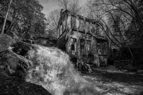
Thomas Willson created the process in which we make calcium carbide. To continue his work on trying to create chemical innovations, he built several facilities. Willson even built his own experimental power station at nearby Meech Lake to power them. Willson’s buildings were left unused after being acquired by an investor following Willson’s bankruptcy.
• https://www.atlasobscura.com/places/carbide-willson-ruins
Loading map...
{"minzoom":false,"maxzoom":false,"mappingservice":"leaflet","width":"auto","height":"350px","centre":{"text":"","title":"","link":"","lat":45.5373,"lon":-75.86619,"icon":""},"title":"","label":"","icon":"","lines":[],"polygons":[],"circles":[],"rectangles":[],"copycoords":false,"static":false,"zoom":10,"defzoom":14,"layers":["OpenStreetMap"],"image layers":[],"overlays":[],"resizable":false,"fullscreen":false,"scrollwheelzoom":true,"cluster":false,"clustermaxzoom":20,"clusterzoomonclick":true,"clustermaxradius":80,"clusterspiderfy":true,"geojson":"","clicktarget":"","imageLayers":[],"locations":[{"text":"","title":"","link":"","lat":45.5373,"lon":-75.8661,"icon":""}],"imageoverlays":null}
Further Beyond Ottawa
Watson’s Mill
5525 Dickinson St, Manotick, ON, Canada
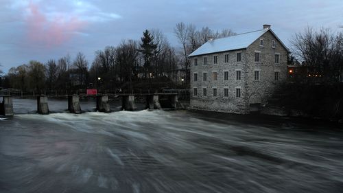
Waston’s Mill is an old grist and flour mill from the 1860s. The original water turbines still power the millstone which is being used to produce flour even today. The site is a working museum that hosts several events for the public
• http://watsonsmill.com
Loading map...
{"minzoom":false,"maxzoom":false,"mappingservice":"leaflet","width":"auto","height":"350px","centre":{"text":"","title":"","link":"","lat":45.227,"lon":-75.6828,"icon":""},"title":"","label":"","icon":"","lines":[],"polygons":[],"circles":[],"rectangles":[],"copycoords":false,"static":false,"zoom":9,"defzoom":14,"layers":["OpenStreetMap"],"image layers":[],"overlays":[],"resizable":false,"fullscreen":false,"scrollwheelzoom":true,"cluster":false,"clustermaxzoom":20,"clusterzoomonclick":true,"clustermaxradius":80,"clusterspiderfy":true,"geojson":"","clicktarget":"","imageLayers":[],"locations":[{"text":"","title":"","link":"","lat":45.227,"lon":-75.6828,"icon":""}],"imageoverlays":null}
Diefenbunker, Canada's Cold War Museum
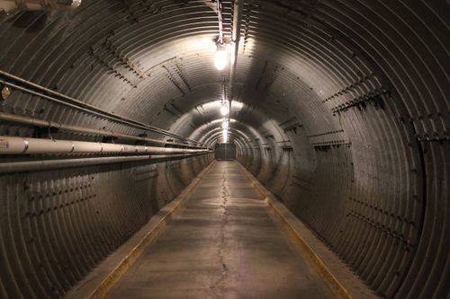
Diefenbunker was built as a giant underground fallout shelter in the event of nuclear war as part of Project EASE. Built from concrete and steel, the bunker was built to withstand a 5 megaton nuclear blast from 1.8 kilometers away. It was first recorded use of critical path construction methodology in Canada. It was transformed into a museum about the Cold War.
• https://diefenbunker.ca/about-the-diefenbunker/
Loading map...
{"minzoom":false,"maxzoom":false,"mappingservice":"leaflet","width":"auto","height":"350px","centre":{"text":"","title":"","link":"","lat":45.3517,"lon":-76.0477,"icon":""},"title":"","label":"","icon":"","lines":[],"polygons":[],"circles":[],"rectangles":[],"copycoords":false,"static":false,"zoom":10,"defzoom":14,"layers":["OpenStreetMap"],"image layers":[],"overlays":[],"resizable":false,"fullscreen":false,"scrollwheelzoom":true,"cluster":false,"clustermaxzoom":20,"clusterzoomonclick":true,"clustermaxradius":80,"clusterspiderfy":true,"geojson":"","clicktarget":"","imageLayers":[],"locations":[{"text":"","title":"","link":"","lat":45.3517,"lon":-76.0477,"icon":""}],"imageoverlays":null}
Military Communications and Electronics Museum
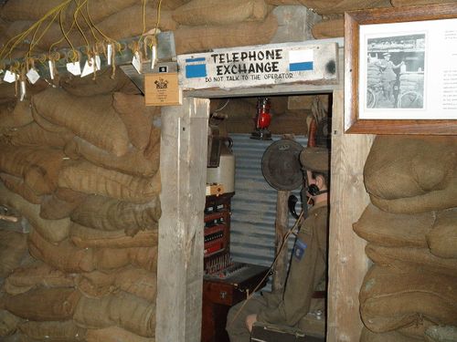
This museum in Kingston displays the equipment and technology used communication and electronic personal from Canada’s Signal Corps. It also features plaster models of the Vimy Memorial.
• https://www.candemuseum.org/about-us
Loading map...
{"minzoom":false,"maxzoom":false,"mappingservice":"leaflet","width":"auto","height":"350px","centre":{"text":"","title":"","link":"","lat":44.242,"lon":-76.439,"icon":""},"title":"","label":"","icon":"","lines":[],"polygons":[],"circles":[],"rectangles":[],"copycoords":false,"static":false,"zoom":7,"defzoom":14,"layers":["OpenStreetMap"],"image layers":[],"overlays":[],"resizable":false,"fullscreen":false,"scrollwheelzoom":true,"cluster":false,"clustermaxzoom":20,"clusterzoomonclick":true,"clustermaxradius":80,"clusterspiderfy":true,"geojson":"","clicktarget":"","imageLayers":[],"locations":[{"text":"","title":"","link":"","lat":44.242,"lon":-76.439,"icon":""}],"imageoverlays":null}
For a list of other Technical History Tours, please click here.
