File:93. Range Diagram.jpg
From ETHW
Size of this preview: 799 × 600 pixels. Other resolution: 870 × 653 pixels.
Original file (870 × 653 pixels, file size: 262 KB, MIME type: image/jpeg)
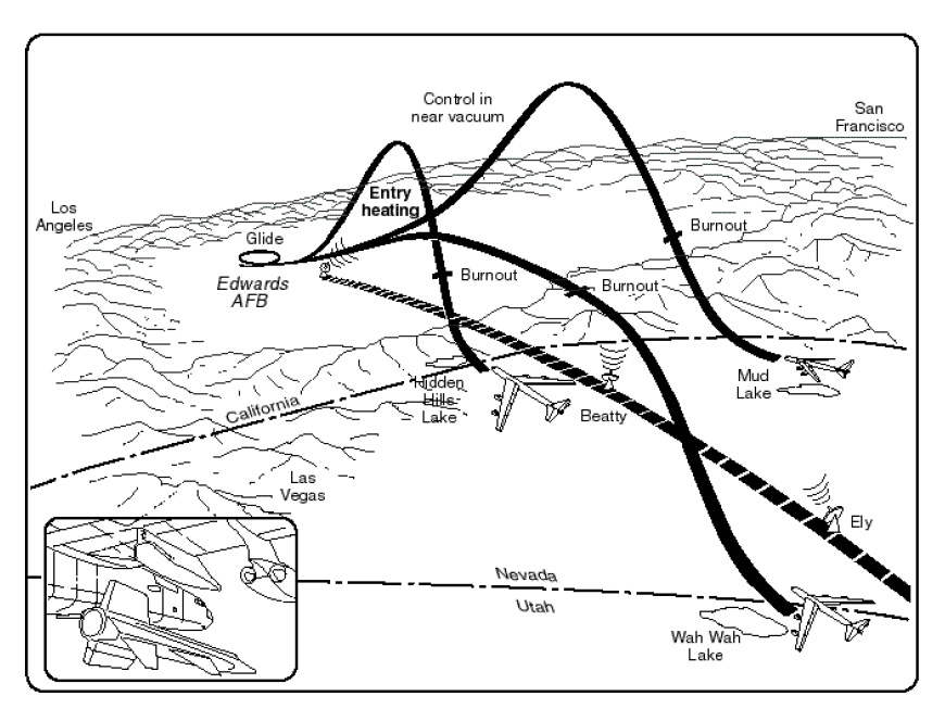
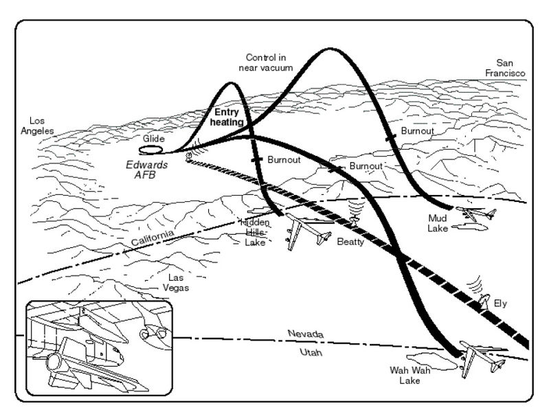
Layout of the High Altitude Continuous Tracking Range (High Range) that extended from Edwards into Utah. Not all of the emergency landing lake beds are shown. NACA diagram
File history
Click on a date/time to view the file as it appeared at that time.
| Date/Time | Thumbnail | Dimensions | User | Comment | |
|---|---|---|---|---|---|
| current | 17:59, 8 August 2016 | | 870 × 653 (262 KB) | Davidboslaugh (talk | contribs) | Layout of the High Altitude Continuous Tracking Range (High Range) that extended from Edwards into Utah. Not all of the emergency landing lake beds are shown. NACA diagram |
You cannot overwrite this file.
File usage
The following page uses this file: